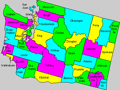
Skagit County, Washington

Welcome to
SKAGIT COUNTY
Skagit County was created in 1883 from Whatcom county.
The county seat is Mount Vernon, 98273.
The County Auditor has birth and death records from 1891 to 1907;
Indian records from 1872; and marriage records from 1884. The County Clerk has divorce, probate, and civil court records from 1883.
Still mostly agricultural, the Skagit Valley is famous for tulips and the spring Tulip Festival.
PLACE NAMES FOR SKAGIT COUNTY:
definitions information from ORIGIN OF WASHINGTON GEOGRAPHIC NAMES as published by Edmond S. Meany, Professor of History at the University of Washington, President of the Mountaineers...etc. Book published 1923 and WASHINGTON STATE PLACE NAMES by James W. Phillips published 1971.
SKAGIT... was the name of an Indian tribe which lived on the river now known by the same name. John Work, of Hudson's Bay Company in 1824, referred to Scaadchet Bay. George Gibbs used the current spelling Skagit on March 1, 1854. (Pacific Railroad Reports, Vol 1, pag 471). The treaty, by which the Skagits ceded their lands was dated January 12, 1855 and used the current form Skagit. Skagit county was created by the Legislature of the Territory of Washington on November 28, 1883 from the southern part of Whatcom County.
...Scatchet Head is a bluff located at the southern extremity of Whidbey Island.
...Skagit Bay and Skagit Island are located near the northern extremity of Whidbey Island.
...Skagit City began with Barker's trading post in 1869. The townsite was platted on the homestead of W. H. McAlpine. It was short lived.
Skait Island, see Skagit.
Allan Island, west of Fidalgo Island, was named in 1841 by the Wilkes Expedition in honor of Captain William Henry Allen of the US Navy. Proof (even with the different spelling A instead of E) is the fact that Wilkes chart shows the waterway between Fidalgo Islands as "Argus Bay" and it was on the Argus that Captain Allen was mortally wounded while fighting the British brig Pelican on Aug 14 1813. It was a favorite scheme of Wilkes to link the name of an American naval officer with his ship by placing two geographic names close together.
...Argus Bay is now Burrows Bay but the old name of the Island remains.
...Allan and Burrows had previously been named by the Spaniards in the "Sutil y Mexicana" Expedition as Las dos Islas Morrows.
Allen. Shingle mill operated by Allen, Roray, and Sanburn was the name course for the Samish River community.
Atlanta, on Samish Island, near Point Williams. "Platted by ex-Sheriff G. W. L. Allen in 1883. He erected a two-story hotel, established a store, secured a post office and built an extensive wharf, but failed in his larger purpose. This was the extent of the town's growth." History of Skagit and Snohomish Counties, page 247.)
 Anacortes, located on Fidalgo Island. It was settled about 1860 and recieved the name of Ship Harbor. In 1876, Amos Bowman, a civil engineer, bought the site and platted a town. He sought to give it the maiden names of his wife - Anna Curtis - but the spelling was purposely changed in order to give a Spanish tone. Anacortes has petrolium processing plants and a huge Marina.
It also has the Ferry Terminal for Victoria and the San Juan Islands. It is a pleasant town, that hasn't gone cutsey tourist, although tourism is a big part of the economy.
Anacortes, located on Fidalgo Island. It was settled about 1860 and recieved the name of Ship Harbor. In 1876, Amos Bowman, a civil engineer, bought the site and platted a town. He sought to give it the maiden names of his wife - Anna Curtis - but the spelling was purposely changed in order to give a Spanish tone. Anacortes has petrolium processing plants and a huge Marina.
It also has the Ferry Terminal for Victoria and the San Juan Islands. It is a pleasant town, that hasn't gone cutsey tourist, although tourism is a big part of the economy.
Avon, established as a "no saloons" temperance town, the first settler there was E. H. Miller 1882. He sold part of his land to A. H Skaling on October 27, 1883 who opened a store. In 1890, H. W. and F. S. Graham started a nearby town which was called North Avon. It is said that those early settlers sought to honor Shakespeare.
Baker, see Concrete
Baker River, a tributary of the Skagit River in Whatcom and Skagit Counties. "In 1877, a party, consisting of Otto Klement, Charles von Pressentin, John Duncan, John Rowley and Frank Scott, set forth from Mt Vernon in canoes manned by Indians to explore the upper Skagit. At the mouth of what the Indians called the Nahcullum river, which Klement renamed Baker River, the party debarked."(from History of Skagit and Snohomish Counties, page 118). The proximity of the Mt Baker was the reason for the rechristening.
Bayview, a town on Padilla Bay. It was platted and named on April 7, 1884 by William J. McKenna, the pioneer who died on May 3, 1915. The object in selecting the place was the desire of D. A. Jennings, a wholesale grocer of Seattle, to establish there a branch store.
Belfast. Name suggested by William Gilmore, pioneer merchant at nearby Edison, to honor his hometown in Ireland.
Bellingham Channel, the waterway between Cypress and Guemes Islands. The Indian name was Tut-segh. The Spaniard Eliza, 1791, called it Canal de Guemes. The present name was given by the US Coast Survey in 1853, taking it, of course, from the large bay just beyond.
Bessemer, a projected town. It was platted by Harrison Clothier in 1890 when the Cokedale mines were opened. It was town in name only.
Big Lake, east of Mt Vernon. It was known as Delacy's Lake."
Birdsview. Name derived in 1880 from that of the first postmaster, Birdsey D. Minkler
Blanchard. Founded by and named for George B. Blanchard about 1885. To avoid duplication of post office designations, the town was renamed Fravel after another pioneer family, but the present name was re-established by vote when the other Blanchard post office was discontinued.
Boulder Reef, off the northwest shore of Sinclair Island, It was discovered and named by the US Coast Survey in 1854. The description includes: " A huge erratic granite boulder is seen at ordinary tides inside the outer point of the reef." The British Admiralty chart of 1859 sought to name this Panama Reef, probably from an accident to the steamship Panama, which was on the San Francisco run during the Fraser River gold excitement of 1858.
Boyd Creek. Named for L. A. Boyd who located a home there in 1882.
Bow. Originally known as Brownsville after William J. Brown, who homestead the townsite in 1869. Advent of the railroad resulted in a population boom and the need for a post office. In deference to the growth brought about by the railroad, Brown suggested the new name of Bow, after the large railway station in London, England - which in turn was named for the bow or poplar tree.
Branham, an obsolete town (as of 1923). Its name was in honor of a man who once ran a shingle mill there.
Broughton Point, on the southeast shore of Cypress Island. The name does not appear on recent charts. It is found on the British Admiralty Chart for 1858-1859, and was undoubtedly given in honor of W. R. Broughton, a lieutenant under Captain George Vancouver, in 1792.
Burlington. Established by John P. Millet and William McKay as a logging camp in 1882, platted by McKay in 1 Jan 1891 and named after Burlington Vt. It has become an important railroad center (as of 1923). Just north of Mt Vernon on the I-5 corridor, Burlington has become the supermall location for Skagit County.
Cement City, a townsite by that name was platted in Skagit County in July 1905. Recent editions (as of 1923) of the Postal Guide do not show such an office at present
Clark Point, on the northern end of Guemes Island in Skagit County. It was named by the Wilkes Expedition, 1841, in honor of Levin Clark, captain of the top in one of the Wilkes crews.
Concrete. The site was first settled upon in 1888 by Richard Challanger. In 1892. a post office was secured and the name Baker applied, as it was at the junction of the Baker and Skagit Rivers. In June 1905, the cement industry started and the Concrete eventually replaced Baker. My first impression - a nice place to end a country drive. (1970's) Last impression - speed trap set along highway running south of town. (1990's)
Conway. Thomas P. Jones and Charles Villeneure settled on the site in 1872. The Great Northern Railway built a line through there in 1891 and Mr. Jones platted the town. Located on the I-5 corridor just south of Mt. Vernon. Conway has no manufacturing base. It depends on the tourism, it is one of the ways to LaConnor. A few Antique Stores, a lively Tavern and hamburger joint, and an eccentric car collector (2005)
Cypress Island, in the western portion of Skagit Co., Eliza's map of 1791 shows the Spanish name as Isla de S. Vincente in honor of a part of the Mexican Viceroy's long name. Captain George Vancouver named the island Cypress in 1792 from the trees he thought were cypress. Botantists have since declared the trees to be junipers.
Day Creek, drains Day lake into the Skagit River. They were named in 1882 for the brothers, John and Mike Day, who had a lumber camp there for years (Matie F. Prenedus, in Names MSS.,
Deception Island, a small wooded island at the western entrance of Deception Pass, near the boundary between Island and Skagit counties. It was named by the US Coast Survey in 1854 after the older name of Deception Pass.
Deception Pass, at the northern end of Whidbey Island, separates Island and Skagit Counties. This is one of the most remarkable geographical features. It was named Boca de Flon by Eliza on the Spanish chart of 1791, but apparently was not explored then. The English explorer, Captain George Vancouver, 1792, had named the inner waterway Port Gardner. Later, one of his small boat crews in command of Master Joseph Whidbey found the western entrance of this passage. Vancouver, feeling that he had been "deceived" as to the nature of his Port Gardner, wrote on his chart "Deception Pass." He also honored his officer, who had found the passage
and who had thus disclosed the existence of an island, by calling the large area, Whidbey Island (Vancouver's Voyage, second edition, Volume II., page 180.) Vancouver said: " A very narrow and intricate channel, which, for a considerable distance, was not forty yards in width, and abounded with rocks above and beneath the surface of the water. These impediments, in addition to the great rapidity and irregularity of the tide, rendered the passage navigable only for boats or vessels of very small burthen." Today, Deception Pass, is a tourist stop. It's natural beauty (high bridge over swirling water, paths down the bank to the water) and the parade of boats 'daring' to navigate the passage attract many sightseers. Deception Pass does have its
share of shipwreck stories and fatalities. The bridge that spans the Pass and the curvey narrow road leading to it, are the only way to Whidbey Island except by ferry.
Deepwater Bay, on the east coast of Cypress Island. It first appears on the British Admiralty Chart, 1859.
Dennis Shoal, a quarter of a mile off the southwest face of Allan Island in Burrows Bay. Captain George Davidson says it was named Denis Rock by the Wilkes Expedition, 1841.
Dewey, town on the southern part of Fidalgo Island. The original name was Deception on account of its location being near Deception Pass. In 1889, F. J. Carlyle and George Loucke secured holdings at Deception City and platted Fidalgo City. Legh R. Freeman also laid out a town near the other, Calling it Gibraltar. After the Spanish-American war the name of Dewey was given to the place in honor of the hero of the battle of Manila Bay.
Dot Island, a small island in Padilla Bay, between Hat and Saddlebag Islands, southeast of Guemes Island. The Wilkes Expedition, 1841, included the little island in a group under the name of Porpoise Rocks. The name of Dot Island appears on the US Coast and Geodetic Survey...corrected to 1904. There is another small island with the same name in Union Bay, Lake Washington, in the city of Seattle, This was named in honor of Miss Dot McGilvra, daughter of John J. McGilvra, the pioneer owner of the land.
Ehrlich, a town in the southwestern part. It was named in honor of F. O. Ehrlich, who had a mill there. (Postmaster, Ehrlich, in Names MSS., Letter 29.)
Equality, name of a social colony which flourished for a short time near Bow. It was called the Freeland Colony. In 1904, the property was sold by the court to satisfy creditors.
Faye Cluckey has created a webpage that has original pictures of the Colony plus family information on surnames Pelton and Irish.
Fidalgo. Two attempts have been made to use this name for towns. One near Deception Pass has been merged into Dewey. The other was on Fidalgo Bay at Munks Landing, where William Munks began a trading post in the {186o's}sixties. A postoffice was established there in 1890 but though it is carried on charts, the US Postal Guide no longer carries the name. (as of 1923)
Fidalgo Bay, off the northeast shore of Fidalgo Island.
Fidalgo Island on the eastern shore of Skagit County. In 1791, the Spaniard Eliza charted what we know now as Rosaria Strait as Canal de Fidalgo. Vancouver in 1792 discovered and named Deception Pass but did not learn that the northern shore was part of a large island. That discovery was made by the Wilkes Expedition, 1841, on whose chart it is shown as Perrys Island in honor of Oliver Hazard Perry of the US Navy. The highest land on the island was called Mount Erie after Perry's famous victory in the Battle of Erie, in the War of 1812. The name of the island was later changed, but that of the mountain remains.
On the British Admiralty Chart, Kellett, 1847, the name of Fidalgo Island appears first and permanetly.
It was a part of Captain Kellett's plan to restore Spanish names as far as he could. In this case the changed the name of a channel to that for an island.
Fir. The place was first known as Mann's Landing, as C. H. Mann settled there in 1876 to take advantage of logging trade. Old settlers say it was the site of an old Indian burial ground.
Flounder Bay on the northwest extremity of Fidalgo Island. See Boxer Cover.
Fravel, see Blanchard.
Freeland Colony, see Equality.
Grandy Creek, a tributary of the Skagit River, named for John Grandy, who located there in 1878. A large Fish hatchery is maintained there by the United States Goverment. (as of 1923)
Guemes Island and Channel, in the northwestern part of Skagit County. The Spanish explorer, Eliza, 1791, named it Isla de Guemes in honor of the Viceroy of Mexico, under whose orders he had sailed to the Northwest. The Viceroy's full name was Senor Don Juan Vicente de Guemes Pacheco y Padilla Orcasitees y Aguayo Condo de Revilla Gidedo. (Pacific Railroad Reports, Volume III, Part I, page 302.) Parts of the long name are in use for geographical names. Vancouver did not attempt to name the island in 1792, but in that year, the Spaniards, Galiano and Vladez
repeated Eliza's name as Isla de Guemes. The Wilkes expedition, 1841, undertook to change the name to Lawrence Island in honor of the famous American naval hero, James Lawrence. To intensify the honor, Wilkes gave the name Hornet Harbor to what is now known as Guemes Channel after the vessel Lawrence commanded when he captured the English Vessel Penguin in the War of 1812, and to the north of the island he charted Penguin Harbor which name has disappeared. In 1847, Captain Kellett restored the name Guemes Island on the British Admiralty Chart 1911. That name has been retained on the US Government Charts, which have also added the names of Guemes Channel and Bellingham Channel.
Hamilton, a town in the central part of Skagit County. William Hamilton settled there in 1877. The town was incorporated in 1891 and named for its founder
Hat Island, east of Guemes Island, in the mouth of Padilla Bay. Wilkes Expedition of 1841 named it Peacock Island in honor of the Squadron's vessel which was wrecked at the mouth of the Columbia River. The subsequent British Admiralty charts show the island without a name. Hat Island was given on account of its shape by the US Coast Survey. Gedney Island, near Everett, is also sometimes locally called "Hat Island."
Jack Island, given by the Wilkes Expedition, 1841, to two islands in the Puget Sound. One of these names has been changed to the Indian name of Squaxin Island, in the southeastern part of Mason County. The other name has persisted. Jack Island is northeast of Guemes Island, in the northwestern part of Skagit. The meaning of the name as applied by Wilkes has not been ascertained.
Jackman Creek, a tributary of the Skagit River at Van Horn, in the northern part of Skagit. It was named for Jack Jackman, who had a homestead and logged off the land near the mouth of the creek in the early '80s. (N. Clark Ely, Van Horn, In Names MSS., Letter 71.)
Kane, an obsolete town (as of 1923) in the northwestern part of Skagit County, named in honor of D. J. Cain, who once operated a shingle mill there. (Noble G. Price, in Names MSS., Letter 48)
Kellyville, see Sedro-Woolley.
Kiket Island, at the entrance to Similk Bay, on the southern shore of Fidalgo Island. The name was given by the Wilkes Expedition, 1841. On Kroll's map of Skagit County it is shown as Kicket Point.
La Conner, a town in the western part of Skagit County and formerly the county seat. The site was first settled in May 1867 by Alonzo Low and the postoffice there was called Swinomish. In 1869, J. S. Conner bought the trading post and the next year had the name changed to honor his wife, Mrs. Louise Ann (Siegfried) Conner. The French-looking "La" was obtained by joining her initials (History of Skagit and Snohomish Counties, pages 201-202. La Conner's major industry was the cannery and the fishing fleet. It now, successfully, blends three different cultures. Fishing, Tourism, and the Arts. And it thrives...even during the off-tourist winter season. The Main street fronts on the slough, with many of the businesses being built on pilings stretching out into the water. The away side businesses back up against a rock cliff. The old town was built hign on a 'big rock' with 50 or so houses. The surrounding land is actually floodplains on which grows the famous Skagit valley tulips.
A large new marina and townhouses have been built and the community has shied away from the supermalls and concentrated on antique stores, galleries, trendy shops, elegrant dining, and a couple of fishermen bars. It is unique.
Lake Erie, a small body of water west of Mount Erie. As the the origin of the name, see Fidalgo Island.
Lake McMurray, a small body of water in the southwestern part of Skagit County. It was named for a pioneer settler on its shores.
Lake Mountains, on Cypress Island in the northwestern part of Skagit County. They have an elevation of 1525 feet. They were named by the US Coast Survey in 1854, "among whose peeks we found two large sheets of fresh water.: (George Davidson, in the Pacific Coast Pilot, page 565.
Langley Point, at the entrance of a bay bearing the same name on the southwestern shore of Fidalgo Island. The Wilkes Expedition, 1841, charted it Point Sares. The present name is probably for a pioneer settler on the bay.
Levant Passage, the waterway between the southeast shore of Guemes Island and Saddlebag, Dot and Hat Islands, in the western part of Skagit County. The name was given by the Wilkes Expedition, 1841, as an added honor for the American navy. He had called Guemes Island Lawrence and Fidalgo Perry naming the waterways after ships commended or captured. The British ship Levant was captured by the Constitution in the War of 1812. Present charts do not carry a name for Levant Passage. (as of 1923)
Lyman, town in the western part of Skagit County. It was named for B. L. Lyman, the first postmaster, in 1880. The townsite was platted in 1884 by Otto Klement. (Postmaster in Names MSS., Letter 34 and History of Skagit and Snohomish Counties, page 246)
Mann's Landing, see Fir.
March Point, east cape of Fidalgo Bay in the western part of Skagit County. The Wilkes Expedition, 1841, shows it as Sacham Point (Vol 23 Hydrography, atlas, chart 92.) It is possible that the present name is an honor for Hiram A. Marsh, who had great success raising cauliflower seed near there in 1891. (Elwood Evans and Edmond S. Mean: The State of Washington page 170/
McMurray, town on the shore of Lake McMurray in the south western part of Skagit County. The town was platted by Dr. Marcus Kenyon when the railroad came in 1890. The name is in honor of a pioneer settler. (History of Skagit and Snohomish Counties. page 241-242.)
Minkler, a town in the western part of Skagit county. It was named in 1897 in honor of the pioneer B. D. Minkler by members of his family. (Matie F. Prenedue, in Names MSS., Letter 34)
Mount Erie, on Fidalgo Island, in the west central part of Skagit County. Elevation 1300 feet. Wilkes in 1841 honored Commodore Oliver Hazard Perry by giving the name Perry Island to what is now know as Fidalgo Island. To intensify the honor he named the peak after Perry's famous Battle of Lake Erie. (US Exploring Expedition, Hydrography, vol 23., Atlas. chart 77.: The name of Perry has been supplainted by the name of the mountain persists as in the case of Mount Constitution.
Mount Sauk, five miles north of Rockport, in the north central part of Skagit County. Like the name of a river in the same vicinity, this name came from that of a tribe of Indians. (Postmaster at Sauk, in Names MSS., Letter 49.)
 Mount Vernon, the county seat of Skagit County, named in March, 1877, by Harrison Clothier and E. C. English in honor of the Virginia home of George Washington. (History of Skagit and Snohomish Counties, page 189.) The Virginia estate was named in honor of Admiral Edward Vernon of the British Navy by Lewis Washington who willed it to his brother George Washington. (Henry Gannett. Origin of Certain Place Names in the United States., page 217.)
additonal Mt. Vernon history in Borseth Biography.
Mount Vernon, the county seat of Skagit County, named in March, 1877, by Harrison Clothier and E. C. English in honor of the Virginia home of George Washington. (History of Skagit and Snohomish Counties, page 189.) The Virginia estate was named in honor of Admiral Edward Vernon of the British Navy by Lewis Washington who willed it to his brother George Washington. (Henry Gannett. Origin of Certain Place Names in the United States., page 217.)
additonal Mt. Vernon history in Borseth Biography.
Northern State Hospital, located at Sedro-Woolley. This description of the Cemetery and burial practices provided by Dona Van Voorst "Re: stones at the NSH Cemetery - there are comparatively few - and the numbers on the stones no longer correspond with the numbers on the cemetery map. People mowed the grass and didn't understand the significance of the numbered
blocks - so they took them up and piled them against the fence - or so the story goes. I have the names of the people who are believed to be buried there
- and there may have been over 2,000 burials - there is also a 'mass burial' of several dozen 'ash cans' which were unclaimed - at Hawthorne Cemetery in Mt.
Vernon. However, one has to remember that those of the Catholic faith HAD to be 'ground burials'. I have heard that they may have been 'stacked' ie. more
than one casket to a grave site. In later years, but before the hospital closed, burials of NSH Catholic pts. were conducted all over the Valley -
particularly in SW and Burlington.
My interest in this was sparked by a man from Arizona who flew here on at least three occasions - looking for his mother's grave site. He was appalled to find
that his mother's final resting place as an unattended pasture and that there were no traditional headstones."
O'Toole Creek, a small tributary of the Skagit River in the central part of Skagit County, named in honor of W. D. O'Toole who located iron mines there in 1885. (Postmaster at Birdsview, in Names MSS.,Letter 130.)
Padilla, a town and bay in the west central part of Skagit county. It was named , in 1791 by Captain Francisco Eliza from another part of the Mexican Viceroy's long name. See the items under Guemes and Orcas. (Chart K. in US Public Documents, Serial Number 1557.) Captain Henry Kellett, in 1847 changed the name to Padilla Bay. (British Admiralty Chart, Number 1911.) That name has remained.
Perry's Island, see Fidalgo Island
Point William, at the southern entrance to Bellingham Bay, near Samish, in the northwestern part of Skagit County, named on June 23, 1792, in honor of Sir William Bellingham. (Meany's Vancouver's Discovery of Puget Sound, page 209.) See Bellingham. It had been named Punta de Solane by the Spanish exploere Eliza. (J. G. Kohl in Pacific Railroad Reports, Volume 12., Part I., Chapter 15., page 302.)
Porpoise Rocks, off the southeast shore of Guemes Island in the northwestern part of Skagit County. They were named by the Wilkes Expedition, 1841, probably after the brig of that name in the squadron. (Hydrography, Vol 23., Atlas, chart 92. ) The names have been changed to Dot, Huckleberry and Saddlebag Islands
Port Lawrence, see Oak Bay and also Guemes Island
Prairie, a town in the northwestern part of Skagit County, named for its location.
Pressentin Creek, a tributary of the Skagit River, in the central part of Skagit County. It was named for Charles Von Presentin, who located a home there in 1876 (Postmaster of Birdsview, in Names MSS., Letter 130.)
Saddle Island, in Padilla Bay, in the northwestern part of Skagit County. The Wilkes Expedition, 1841, included it as one of the Porpoise Rocks (Hydrography, Vol 23, Atlas chart 92.) the US Coast and Geodetic Survey Chart 6577 shows the present name evidently derived from the shape of the island.
Samish, a bay, island, river and town in the northwestern part of Skagit County and a lake in the southwestern part of Whatcom County, all from the name of a tribe of Indians which formerly lived in that region. (Myron Eells, in american Anthropologist for January, 1892)
Sandford Cove, at the northwest extremity of Fidalgo Island, Skagit County, named by the Wilkes Expedition, 1841, in honor of Thomas Sandford, quartermaster, in one of the crews. (Hydrography, Vol 23., page 310 and Atlas, chart 92.) See also Point Sandford. The name of the cove has not persisted. See Boxer Cove and Flounder Bay. The US Coast and Geodetic Survey Chart 6377 now shows the little Sandford Cove to be Flounder Bay.
Sauk, the name of a river, mountain and railway station in the central part of Skagit county. The name is from that of a tribe of Indians. (Postmaster at Sauk, in Names MSS., Letter 49.) The postoffice of that name was established in 1884. (History of Skagit and Snohomish Counties, page 244.) George Gibbs writing on March 1, 1854, said the Indians had a portage from the north fork of the Stilaguamish to the Sah-Kee-mehu branch of the Skagit. (Pacific Railroad Reports, Vol 1., page 472.
Sedro-Woolley, a city in the west central part of Skagit County. The place was first settled in 1878 by David Batey and Joseph Hart. In 1884, Mortimer Cook bought forty acres and planned a town. Desiring a name that would be unique he called it Bug. The settlers did not like the lack of dignity and threatening to prefix the syllable "Hum" to the sign at the river landing. Mrs. Batey said she found Sedro in the Spanish dictionary as meaning cedar.
As there were many fine trees there of that species "Cedro".
In 1890, Norman R. Kelly platted some land and his part of the town was known as Kellyville. With the boom of 1890, Philip A. Woolley started a rival town nearby under the name of Woolley.
The dual government was expensive and on December 19, 1898, the movement for consolidation was successful, resulting in the hyphenated name of Sedro-Woolley. (History of Skagit and Snohomish Counties, pages 219-227. Sedro-Woolley was the home of Northern State Hospital (see it's own listing), a mental facility run by the state until closed in the 60's
Shannon Point, a northwestern cape of Fidalgo Island at the western edge of Skagit county. It was charted as Ship Point by Captain Richards, 1858-1859. (British Admiralty Chart 2689.) For a reason not ascertained, American geographers have given the present (as of 1923) name. (US Coast and Geodetic Survey Chart 6300)
Ship Harbor, east of Shannon Point, at the northwestern extremity of Fidalgo Island (US Caost and Geodetic Survey Chart 6377.) "The superior excellence of Ship Harbor had been known perhaps even before the US vessel Massachusetts began making it her headquarters - a circumstance which is said to have given it its name". (History of Skagit and Snohomish Counties, page 89.)
Ship Point, see Shannon Point
Similk Bay, on the southern shore of Fidalgo Island, northeast of Description (sic) Pass, in the west central part of Skagit County. It was named by the Wilkes Expedition, 1841. (Hydrography, Vol. 23., Atlas, chart 90.) The name is retained on the US Coast and Geodetic Survey Chart 6380.)
Sinclair Island, north of Cypress Island, at the northwest corner of Skagit County. It was named by the Wilkes Expedition, 1841. (Hydrography, vol 23., Atlas, chart 77.) Since Wilkes was naming the islands of this archipelago for "distinguished officers late of the U.S. naval service", it is probable that this honor was for Arthur Sinclair, Sr., Commander of the Argus in the War of 1812. (E. S. Maclay: History of the Navy, Vol 1., pages 183, 383, 427, and 491.)
Siwash Slough, near Samish, in the northwestern part of Skagit county. "Daniel Dingwall seems to have been the pioneer merchant of the Samish country, having established a store in partnership with Thomas Hayes, in the fall of 1869 on Samish Island, adjoining the Siwash Slough. The Siwash Slough was so called from the location upon it of two thousand Siwashes engaged in fishing and hunting." (History of Skagit and Snohomish counties, page 111.) "Siwash is the Chinook Jargon word for 'Indian" and is a corruption of the French word 'sauvage'". (Rev. Myron Eells in the American Anthropologist, for January, 1892.)
Sterling, a town in the west central part of Skagit County, founded in 1878 by Jesse B. Ball, who crossed the plains in 1853 and became a well known pioneer farmer and logger. (History of the Pacific Northwest: Oregon and Washington, vol 11, page 200.)
Strawberry Bay, on the western shore of Cypress Island, in the northwestern part of Skagit County. The island the the bay were both named from plants found there. The great English explorer, Captain George Vancouver, anchored there on June 6, 1792, Discovery of Puget Sound, pages 174 and 176
Strawberry Island, a small island at the mouth of Strawberry Bay. It was left nameless by Vancouver, when he named the bay and the larger Cypress Island. The Wilkes Expedition, 1841, found berries on the little island and named it Hautboy. (Hydrography, Vol 23, Atlas, chart 77.) This name is pronounced "Hoboy" and is the common name of "Fragaria elatior", a species of strawberry. (New Standard Dictionary, page 1123. On most of the recent maps (as of 1923) the little island is charted as Strawberry Island.
Suiattle, one of the headwater streams of Skagit River. The name is evidently of Indian origin, but its meaning was unknown to Dr. Charles M. Buchanan, the best authority in that field, (In Names MSS. Letter 155.)
Sutter Mountain, in the central part of Skagit County, named in honor of John Sutter, an old time white settler, (postmaster at Sauk in Names MSS. Letter 49.)
Swinomish Slough, a waterway between Skagit Bay and Padilla Bay in the western part of Skagit County. On its east bank is the town of La Conner which was one time called Swinomish. Opposite the town is the Swinomish Indian Reservation. The name comes from that of a branch of the Skagit tribe of Indians.
Thorne, in Skagit County, was homesteaded by 1893, by Woodbury J. Thorne and a postoffice by that name was established there in 1900. (History of Skagit and Snohomish Counties page 247.)
Thornwood, a station on the Northern Pacific Railway, in the west central part of Skagit County. The name is in honor of W. J. Thorne, a settler in that vicinity. (Noble G. Rice, in Names MSS. Letter.)
Urban, a post office on Sinclair Island, in the northwestern part of Skagit County, was named by L. U. Stenger in honor of his son Urban Stenger. (Elizabeth A. Schultz, in Names. MSS. Letter. 113.)
Van Horn, a town in the central part of Skagit County, was named for the founder, James V. Van Horn. (Postmaster at Van Horn, in Names MSS. Letter 363.)
Vendovi Island, in the northwestern corner of Skagit County, was named by the Wilkes Expedition, 1841, for a native of Fiji, (of Viti) Island, whom he had captured and carried northword to these waters. Wilkes, in the Narrative, Voluem 111., page gives a picture of Vendovi and tells about his capture (page 131) and of his leave-taking, (page 136). In Volume 4, page 297, while describing the indians of the Strait of Juan de Fuca, Wilkes records: "It was amusing to us, who had no very exalted opinion of the Feejians, to observe the contempt of our prisoner Vendovi entertained for these Indians, which was such that he would hardly deighn to look at them." The Expedition reached home on June 10, 1842. Captain Wilkes, in Vol 5., page 453, makes this entry: "On our arrival home, the health of the prisoner Vendovi had so far declined that it was necessary to place him in the Naval Hospital at New YOrk. Every attention was paid him there, but very soon afterward he expired." The spanish name for Vendovi and Sinclair Islands was Islas de Aguayo Galiano and Valdes map, in US Public Documents, Serial Number 1557, Chart L.) see also Viti Rocks.
Whitney, a town in the west central part of Skagit county, was named in honor of Rienzie E. Whitney, a pioneer who in 1882 founded the town of Padilla. When the railroad came in 1890 the town was moved and its name was changed to Whitney. (History of Skagit and Snohomish Counties, page 245.)
Williamson Rocks, off the west shore of Fidalgo Island, in the west central part of Skagit County, were named by the Wilkes Expedition, 1841, in honor of John G. Williamson, Gunner on one of the ships. (Hydrography, vol 23., Atlas chart 77.)
Young Island, at the eastern end of the passage between Allen and Burrows Islands, in the west central part of Skagit County, was named by the Wilkes Expedition, 1841, probably in honor of Ewing Young, the Oregon pioneer whose farm had been visited by Captain Wilkes, (Narrative, vol 4., pages 3588-360.)
Completed and 1st proof Jan 1999
member of USGenWeb Project since 1996
this page is sponsored by:
3rd St. Books Exchange
Marysville WA
all rights reserved @1996-2002